
Belmont Avenue - Kimball to Western / Clybourn
 Belmont Avenue - Kimball to Western / Clybourn
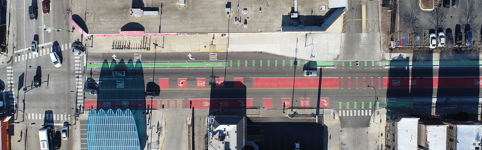
CDOT has transformed Belmont Avenue between Kimball Avenue and Western Avenue / Clybourn Avenue with a bold design that prioritizes and balances the needs of people walking, biking, and riding the bus throughout the day. This segment of Belmont provides connections to the CTA Belmont Station, the 312 RiverRun trail, and multiple intersecting bike routes.
The new protected bike lanes also connect with those on Campbell Avenue and lead into the Roscoe and School Street routes, providing low-stress access all the way to the Lakefront Trail. As a crosstown route, Belmont crosses significant network barriers like the Kennedy Expressway and the North Branch of the Chicago River that would otherwise separate communities, making this project critical for everyday users.
- Improves bus operations through dedicated bus lanes and bus boarding infrastructure
- Enhances pedestrian safety by shortening crossing distances with bump-outs and bus boarding infrastructure
- Expands Chicago’s low-stress bike network on a key east-west connection
- Connects with CTA Blue Line, Kedzie Avenue and Campbell protected bike lanes, and other cycling networks
- Creates key cycling connection over the Chicago River
- Provides better access to local businesses
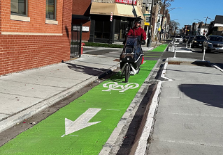
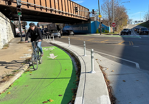
Exclusive space for people biking to physically separate them from motor vehicle traffic on Belmont Ave, especially at bridges and underpasses
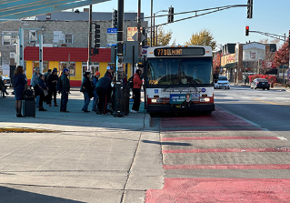
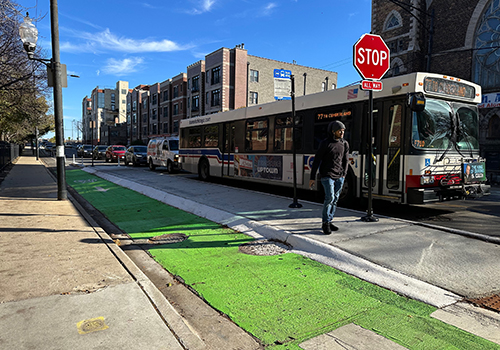
Dedicated lanes to help prevent buses from getting stuck in traffic and to keep other vehicles clear from bus stops
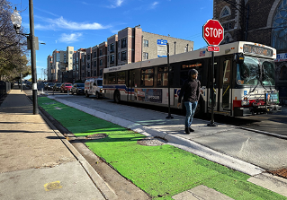
Exclusive spaces for bus riders to increase comfort and to streamline transit so buses do not need to merge in and out of traffic at stops
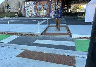
Curb bump-outs and concrete refuge islands to reduce crossing distances for people walking across Belmont Ave
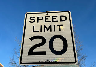
Lowered speed limits and narrower travel lanes to reinforce safer vehicle speeds and a lower-stress environment for people on foot and on bike
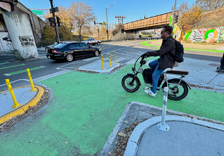
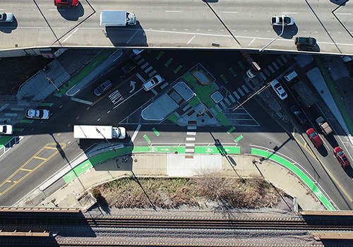
A protected intersection at Belmont Ave and Kedzie Ave to give cyclists a safer, more visible space to wait for signals and reduce conflicts with vehicles at the wide multi-lane crossing
Belmont Avenue from Kimball Avenue to Western / Clybourn.
-
Construction - Completed Fall 2023